WP 1.0 (Water Resources Planning and Integral Water Strategies) coordinates the work in Block 1 and integrates the results. For water allocation studies, water budget calculations in higher spatial resolution are now required and water demand centers need to be defined. In principle, different variants of water production and allocation in combination with SWAP agreements are conceivable to cover the water deficits and to rehabilitate the ecosystems. Under WP 1.0, the priority variants are identified, detailed, and evaluated with the multicriteria analysis developed under WP 3.0. The process takes place in close interaction with Block 2 (system operation and management).
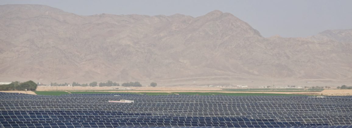
WP 1.1 (Seawater Desalination & Energy) provides a simulation tool that evaluates innovative seawater desalination technologies (membrane-based and thermal desalination) and various renewable energy combinations in the region, based on economic and environmental objectives. The goal is to adapt the quantity and quality of desalinated seawater to the demand while considering the daily and seasonal variability of energy production. Methods and recommendations to select seawater desalination technologies under conflicting objectives (“cost vs. ecology”) are also to be provided. Furthermore, a concept for a water-energy SWAP between Israel and Jordan is to be developed.
WP 1.2 (Water Supply) is intended to provide planning options for the energy-efficient and economical expansion of the infrastructure for water transfer and allocation to the demand centers. The alternatives for hydro-infrastructure development are evaluated with relevant indicators, taking the impact on wastewater production and management into consideration.
WP 1.3 (Wastewater Management & Reuse) will develop planning options for the stepwise expansion of wastewater infrastructure and the reuse of treated wastewater in Jordan and Palestine, particularly for agricultural purposes and freshwater resource protection. The planning variants are to be evaluated by means of indicators in the context of a potential analysis, taking country-specific reuse and groundwater protection scenarios into account. For deployment at the regional level, the GIS-based decision tool “ALLOWS” (BMBF-Smart) is to be further developed. The definition of previously missing wastewater reuse indicators should contribute to the implementation of Sustainable Development Goal (SDG) No.6. Data gaps should be closed with the help of satellite images and remote sensing. The new tool “ALLOWS-REGIO” will be used to define wastewater disposal clusters and compare the cost of different planning options. With the help of the innovative tool, recommendations for the development of the wastewater infrastructure will be derived and priority regions for future investments will be selected.